INIFED: National Institute of Physical Education Infrastructure

Photograph by Rodrigo Alvarado Vázquez, 2017.
Address: Vito Alessio Robles 380, Florida, Álvaro Obregón, 01030
Description:
In between 1950 and 1960, architect Francisco Artigas designed at least fifty modernist houses at the Pedregal de San Angel. In 1967, as head of the Federal Program for School Construction (CAPFCE), he designed for their headquarters a quadrangular two-level building, On February 1, 2008, the CAPFCE became the National Institute of Educational Physical Infrastructure (INIFED).
Read more
Vito Alessio Robles Median Strip
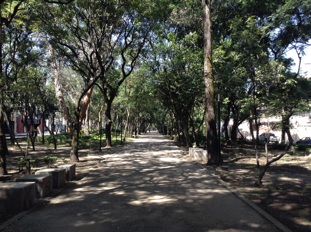
Photograph by Rodrigo Alvarado Vázquez, 2017.
Address: Vito Alessio Robles s/n, Florida, Álvaro Obregón, 01030
Description:
“La Florida” is a neighborhool in the southern part of Mexico City that was founded around 1950, on what was once the Hacienda de Guadalupe. Its streets are named after fruits and flowers, hence the median strip Vito Alessio Robles, was once street formerly known as “Cedar Street”. The median strip runs from Ave. Universidad and ends in Ave. Insurgentes Sur. At its intersection with Insurgentes Sur, there is a bronza sculputre of Vito Alessio Robles, a courageous...
Read more
St Thomas More Parish
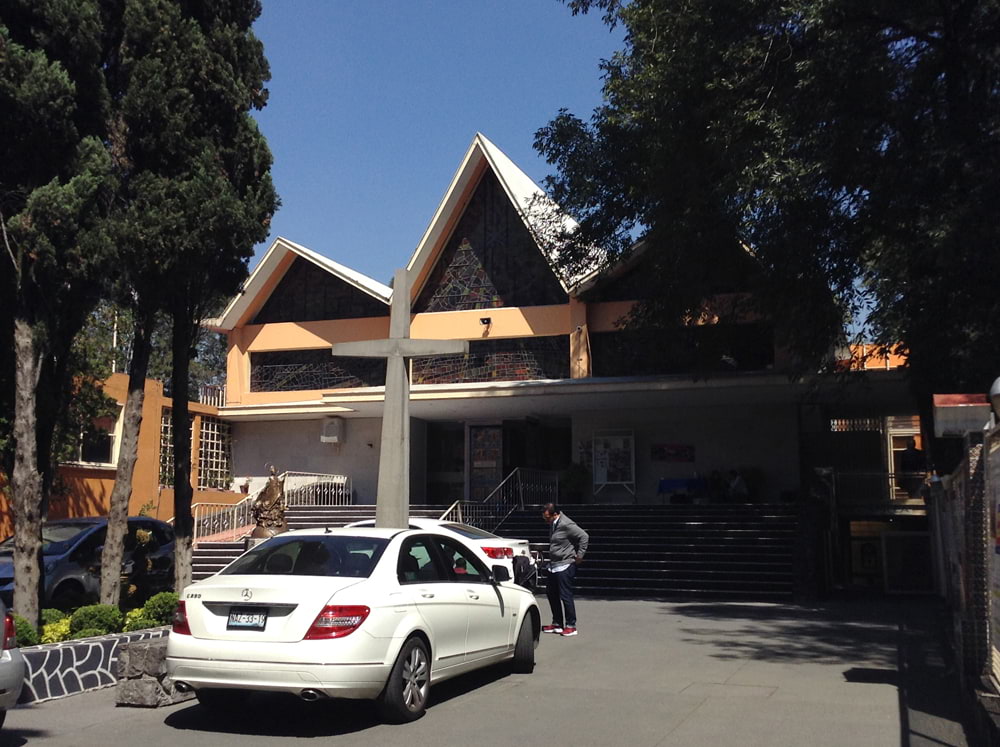
Photograph by Rodrigo Alvarado Vázquez, 2017.
Address: Vito Alessio Robles 206, Florida, Álvaro Obregón, 01030
Description:
St. Thomas More, a diplomat and theologian, is the patron saint of this Parish, mostly serving the German-speaking community in Mexico City. The Parish offers every Sunday, a mass delivered in German. The author of Utopia, a book about an imaginary island with a perfect political system, St. Thomas More, was named the patron saint of politicians by Saint John Paul II in 2000. At the atrium, a fountain commemorates this designation. The remains of influential Mexican politicians were put to rest...
Read more
Maronite Catholic Eparchy of Our Lady of the Martyrs of Lebanon
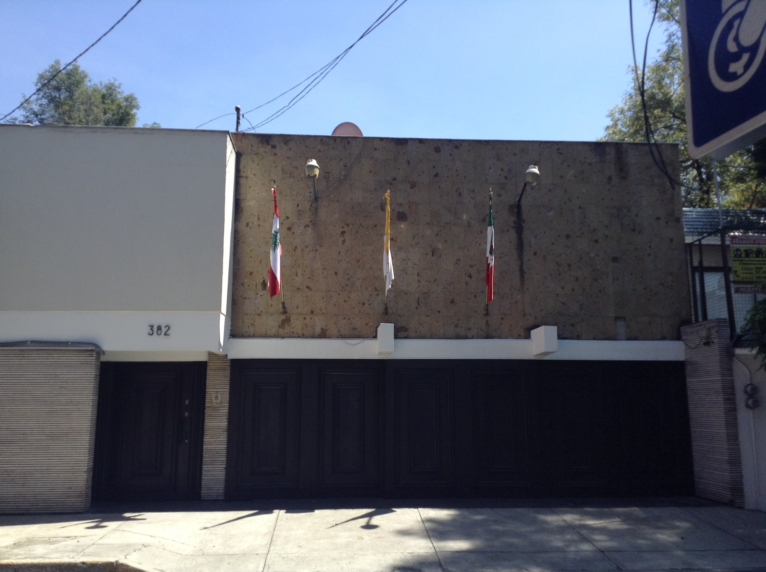
Photograph by Rodrigo Alvarado Vázquez, 2017.
Address: Margaritas 382, Florida, Álvaro Obregón, 01030
Description:
Around 1878, the Lebanese community began its migration to Mexico, bringing with them their faith in St. Maron, defender of Christian learning in the Middle East. The Eparchy of Our Lady of the Martyrs of Lebanon was approved by Pope John Paul II on November 6, 1995. Bishop Dr. Wadih Boutros Tayah who bought the Episcopal House, was its first Eparch. After his passing in 2002, the Holy See appointed Bishop George S. Abi Younes, as leader of the Eparchy.
Read more
Viveros Metro Station
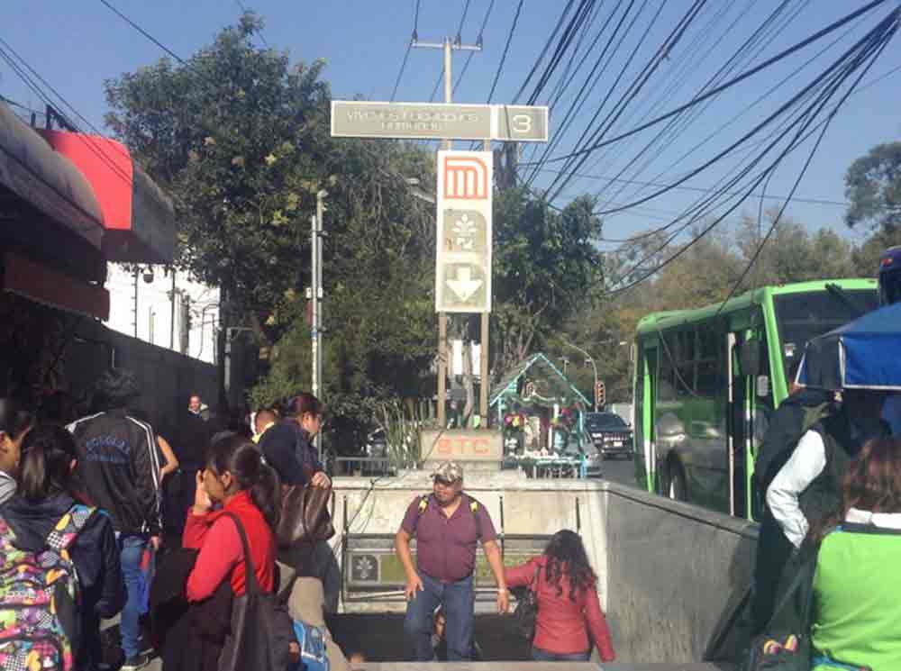
Photograph by Rodrigo Alvarado Vázquez, 2017.
Address: Av. Universidad y Vito Alessio Robles, Florida, Álvaro Obregón, 01030
Description:
On August 20, 1983, " Viveros" Metro Station was inaugurated to connect its passengers with “Indios Verdes”. Due to its proximity to the Human Rights Commission and the "Viveros National Park", the icon designed for this metro station shows a plant blooming from dove-shaped hands, symbolizing peace. Before accessing the subway cars at metro station, there is a mural by North American artist Jason Schell, entitled "A Sunday Afternoon in Mexico City",...
Read more
'Gandhi' Bookstore
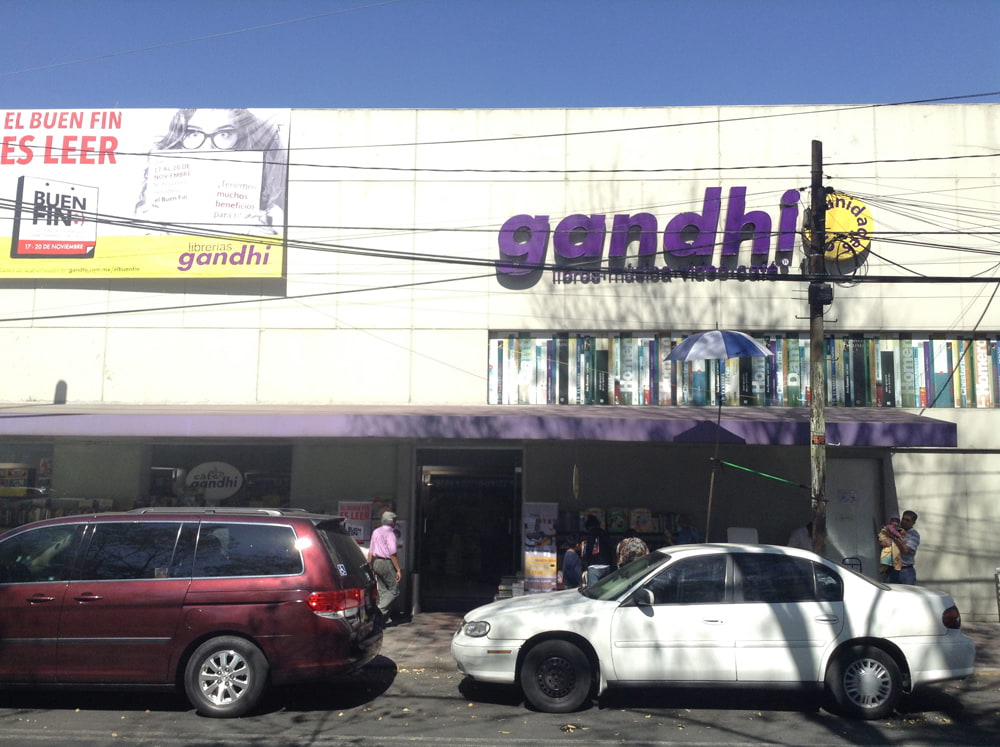
Photograph by Rodrigo Alvarado Vázquez, 2017.
Address: Av. Miguel Ángel de Quevedo 134, ex Hacienda Guadalupe-Chimalistac, Álvaro Obregón 01050
Description:
Gandhi bookstore opened its doors to its customers in 1971. Located on Av. Miguel Ángel de Quevedo, the coffee shop on the mezzanine was crowded in the afternoons, as it too offered cultural activities. Gandhi bookstore is now a brand including 38 stores all over Mexico, even small book sections at shopping malls and airports, and on-line services. Becoming an ideal destination to buy books, it influenced other bookstore...
Read more
Cedros School Center
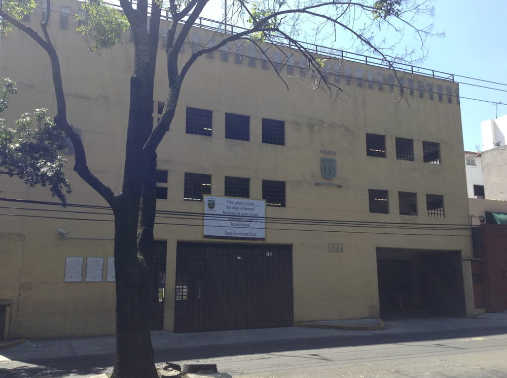
Photograph by Rodrigo Alvarado Vázquez, 2017.
Address: Tecoyotitla 364, ex Hacienda Guadalupe-Chimalistac, Álvaro Obregón, 01050
Description:
The “Cedros” School Center, ruled by the Opus Dei principles of Saint Josemaría Escrivá de Balaguer, was founded in 1967, in what were the grounds of the former “Hacienda de Chimalistac”. The exterior stone wall was part of the Hacienda. The school ows its names to its location, on the corner of what was once a median strip flanked by cedar trees and that was called Cedar Avenue, now Vito Alessio Robles. The cedar tree, represented in the school’s...
Read more
Tagle Park
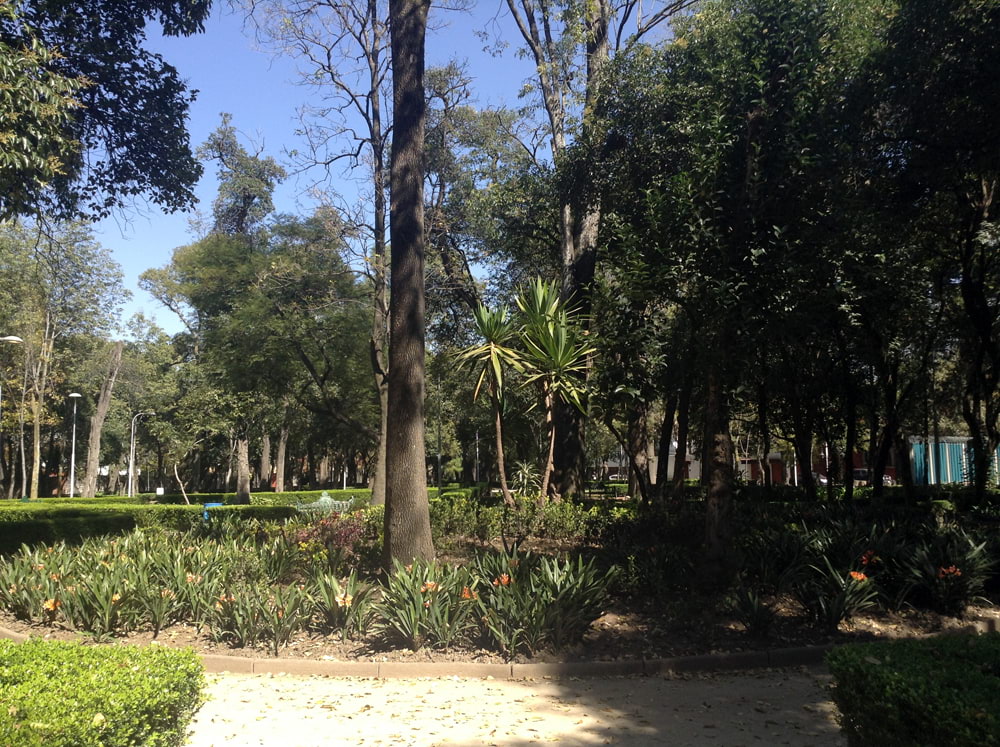
Photograph by Rodrigo Alvarado Vázquez, 2017.
Address: Av. Miguel Ángel de Quevedo, esq. con Arenal, Agrícola, Álvaro Obregón 01050
Description:
Located in the southern part of Mexico City, Chimalistac was part of Coyohuacan. In 1410, Maxtla, the son of Tezozomoc of Azcapotzalco, ruled what is now the neighboordhood of Coyoacán. In 1430, Coyoacán became a tributary province of the Triple Alliance, a political pact among the rulers of Tenochtitlan, Texcoco and Tlacopan. The arrival of Hernán Cortés to Tenochtitlan put an end to the Aztec ruling of the Basin of Mexico. Aided by local rulers, Cortés...
Read more
Observatorio Metro Station
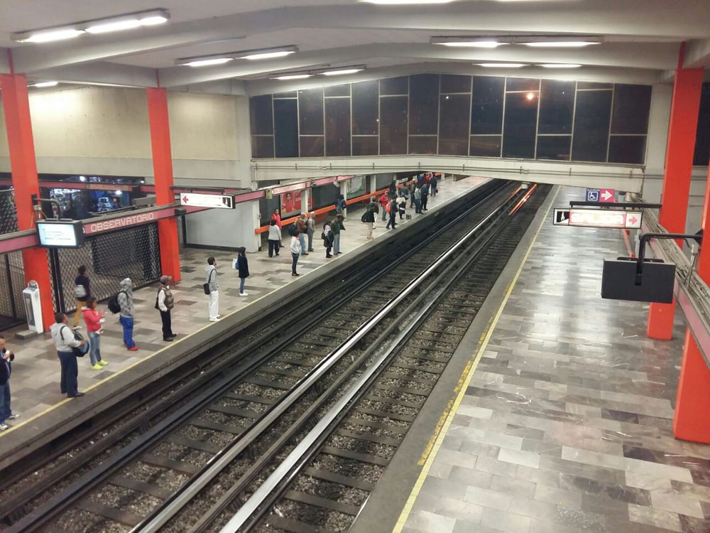
Photograph by Rita Mariana Oznaya Angeles, 2016
Address: Calz. Minas de Arena, Acueducto, Álvaro Obregón, 01120
Description:
Metro Station “Observatorio” opened on June 10, 1972, as part of Metro Line 1 of Mexico City, the oldest line in the network. In 1908, the Astronomic Observatory of Tacubaya was founded a few blocks from the metro station. In 1929, the Observatory became a research facility of Mexico’s National Autonomous University. Due to the growing traffic and urbanization of Mexico city, the Observatory was moved in 1951 to Tonantzintla, Puebla. Next to the metro station is one the bus...
Read more
Shrine of Santa Muerte (St. Death)
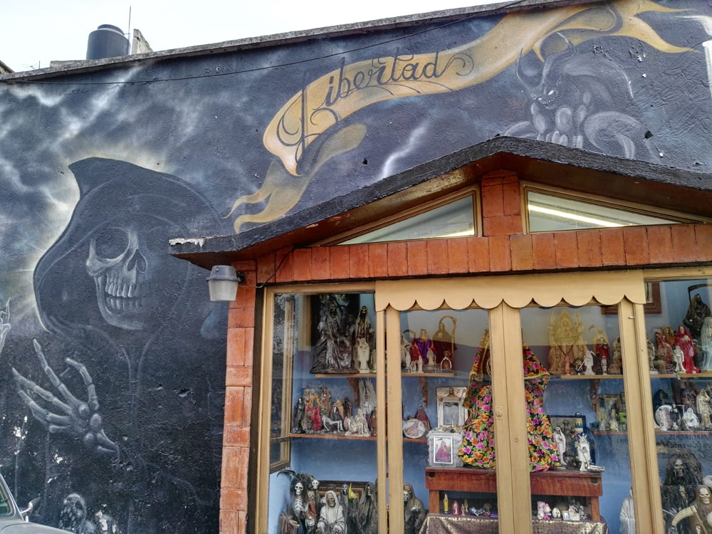
Photograph by Rita Mariana Oznaya Angeles, 2016.
Address: Acueducto Leones 43, Colonia Acueducto, Álvaro Obregón, 01120
Description:
At Acueducto Leones, there is a shrine dedicated to St. Death or “Santa Muerte”, framed by a large mural painted on a wall. There are approximately 100 figures of the “Santa Muerte”. The devotees constantly change the attire of the main figure, leave candles and clean the shrine. On the fist day of the month, Santa Muerte is venerated with “mariachis” .
Read more
Jewish Cemetery
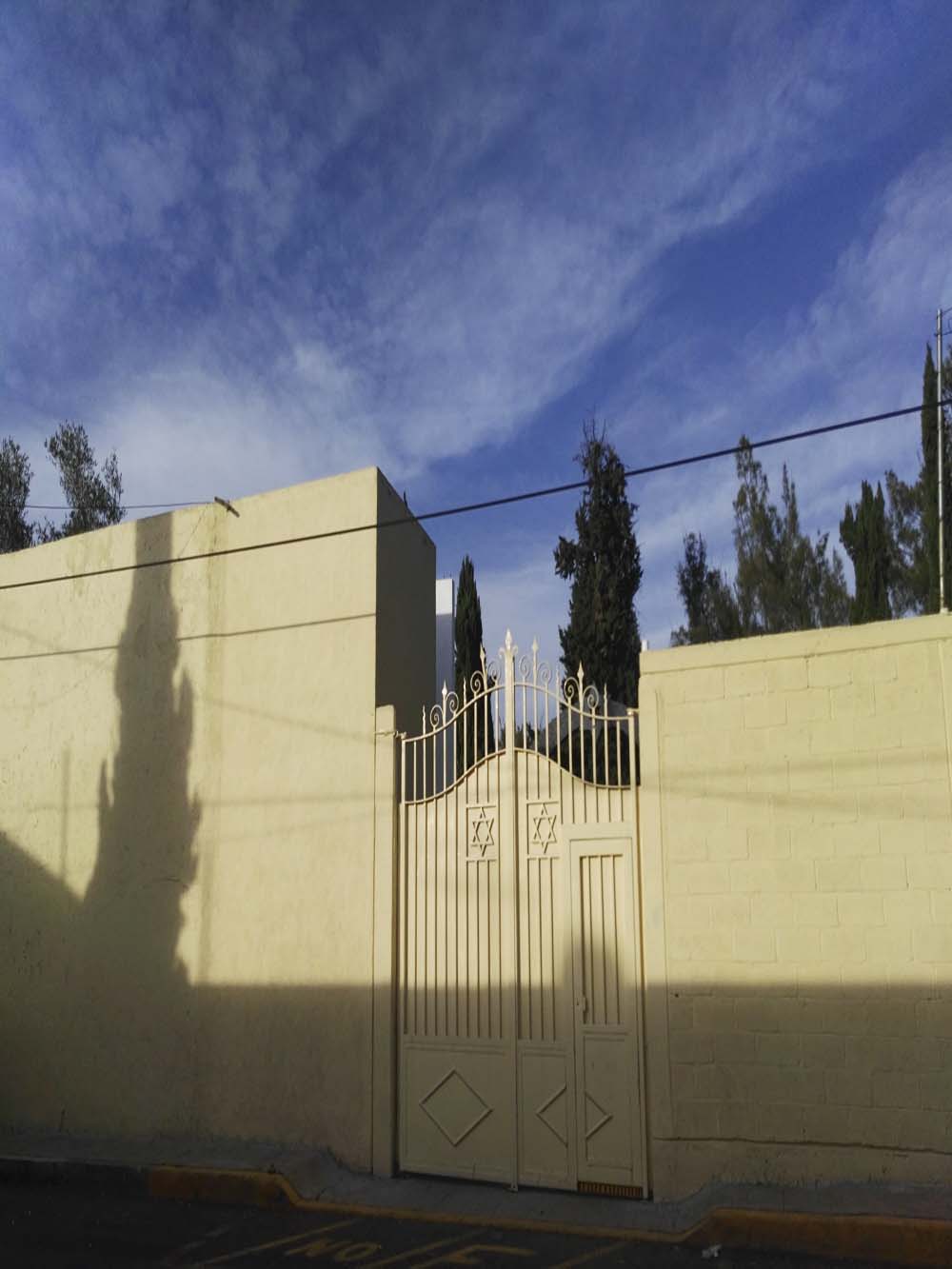
Photograph by Rita Mariana Oznaya Angeles, 2016.
Address: Sur 138 34, América, Álvaro Obregón, 11810
Description:
The Ashkenazi community built this cemetery with an open Holocaust Memorial, with an area covered with stones, fitting symbols of the lasting presence of the deceased’s life and memory. In May, on Remembrance Day, a ceremony takes place in memory of those that lost their lifes during the Holocaust. At the center of the Memorial, a rusted metal legend written in Hebrew, reads, “The people of Israel are alive."
Read more
ABC Hospital
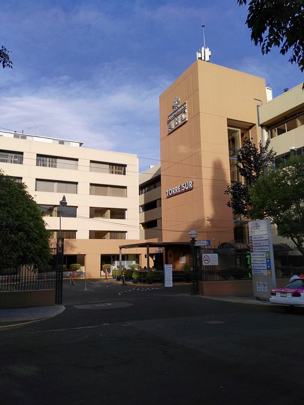
Photograph by Rita Mariana Oznaya Angeles, 2016.
Address: Sur 136 No. 116, Las Américas, Álvaro Obregón 01120
Description:
In 1886, the American Benevolent Society built The American Hospital on Gabino Barreda Street in Mexico City’s Colonia San Rafael. In 1957, Mr. S. Bolling Wright, donated a 13,000 m2 terrain, to built of the first private medical center in Mexico City, what is now the ABC hospital in Ave. Observatorio. Gordon Freeson was the architect behind the project. In 1964, the ABC was forced to open before its inauguration to help the victims of the Western Airlines plane crash at Mexico City...
Read more
The American School Foundation, A.C.
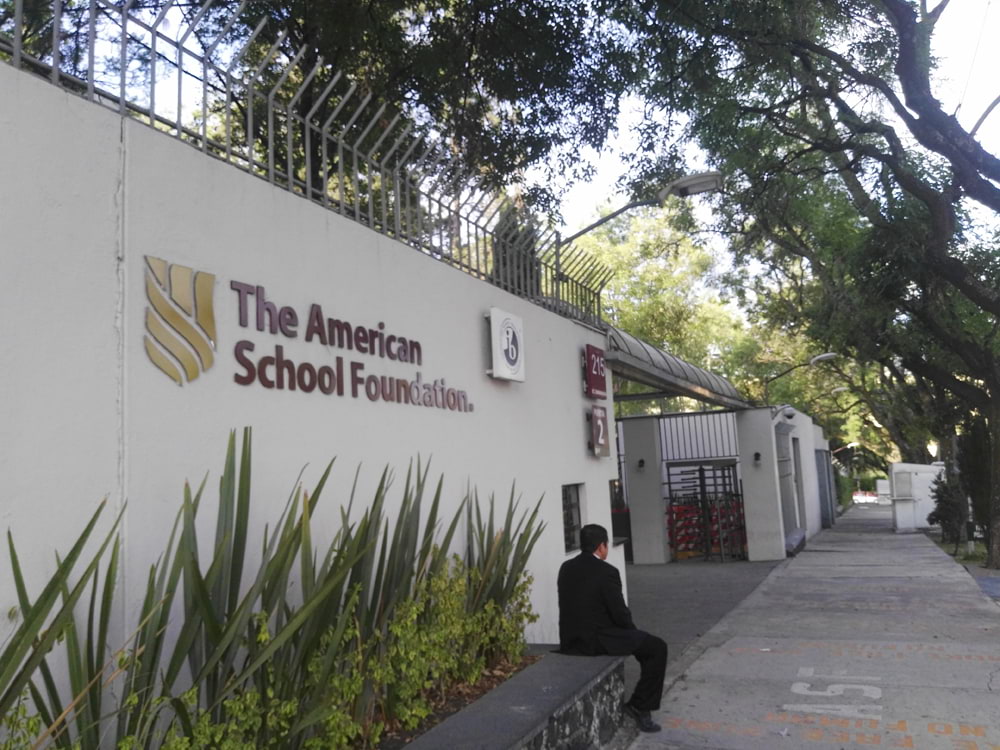
Photograph by Rita Mariana Oznaya Angeles, 2016.
Address: Bondojito 215, Las Américas, Álvaro Obregón, 01120.
Description:
The history of the American School foundation American businessmen began on August 6, 1888, with the opening of a kindergarten with only nine children, in the private home of oilman John Davis, who lived in downtown Mexico City. Eventually, the American School attracted the children of American, British and Mexican families, who wanted an education in English for their children. As the school expanded, its headquarters and name changed several times. The school faced many challenges. During the...
Read more
Aqueduct
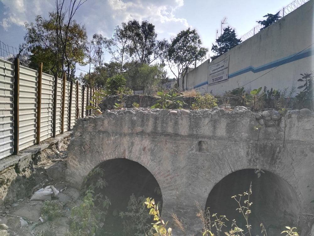
Photograph by Rita Mariana Oznaya Angeles, 2016.
Address: Sóstenes Rocha, esquina Calle Sur 122, COVE, Álvaro Obregón, 01120
Description:
In 2012, an aqueduct of the colonial period was found during the excavation to build a home health care for elderly people. The aqueduct was part of the hydraulic system that transported water to Mexico City from Cuajimalpa. Despite that the aqueduct is fenced to avoid any damage, its state of conservation is poor.
Read more
Elementary School "7 de enero de 1907"
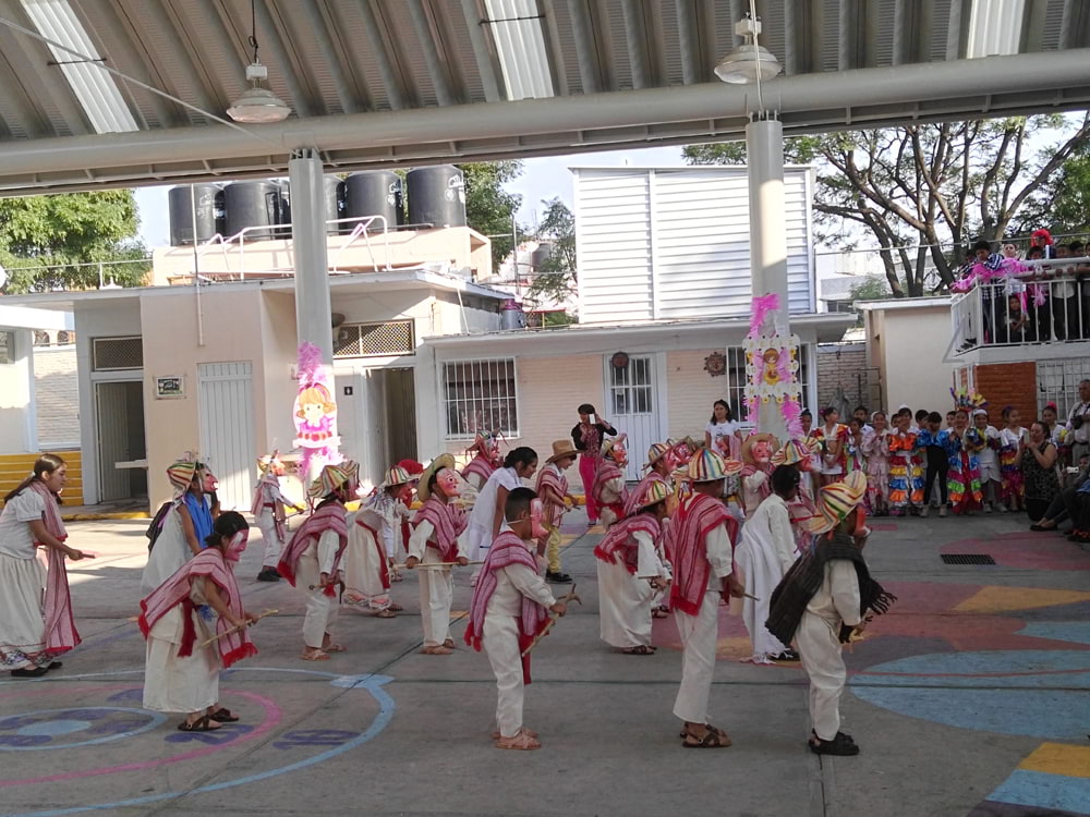
Photograph by Rita Mariana Oznaya Angeles, 2016.
Address: Sostenes Rocha 10, COVE, Álvaro Obregón, 01120
Description:
In 2010, the elementary public school received the visit of the First Lady of the United States, Michelle Obama, during her first official visit abroad, as part of the mentoring program of the American School Foundation. The students held a ceremony to honor the First Lady of the United States. It is one of the most recognized public schools in Mexico City, for its top performance during the “Enlace” national evaluacion test. In 1963, one of Mexico’s most famous comedian,...
Read more
St. Philip of Jesus Parish
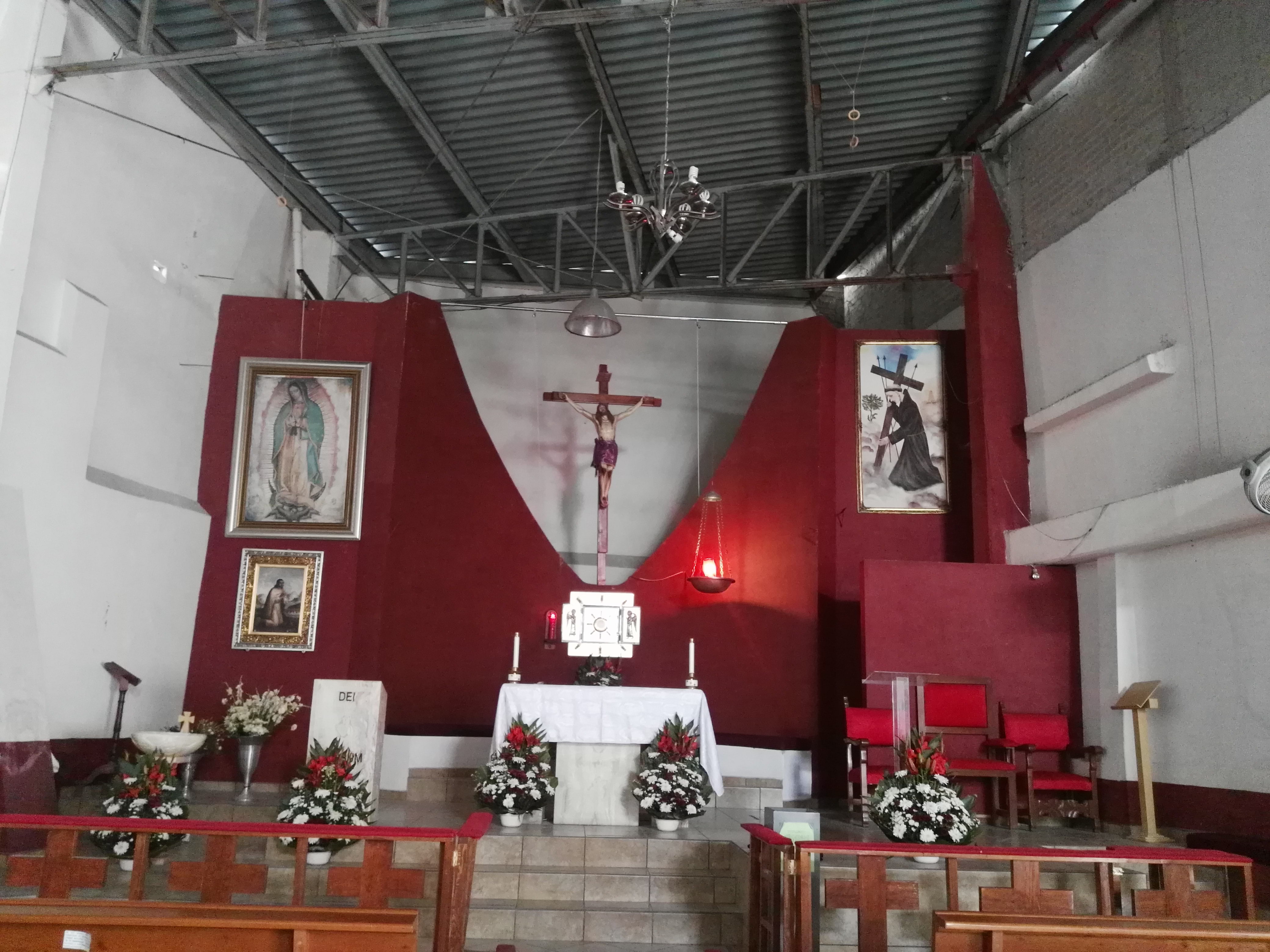
Photograph by Rita Mariana Oznaya Angeles, 2016.
Address: Jilguero 44, José Ma. Pino Suárez, Álvaro Obregón, 01140
Description:
The Parish was built in the second half of the 20th century, on what was once a soccer field. Inside the parish, there is a sculpture of St. Philip of Jesus, placed on a pedestal with an inscribed metal plate, commemorating the 150th anniversary of his canonization. In this neighborhood, a street gang, "La Banda de los Panchitos", terrorized Mexico City in the 1980s. The Parish has helped young people in the area by offering them spiritual counseling and caring for them in any way...
Read more
Sunday Street Market
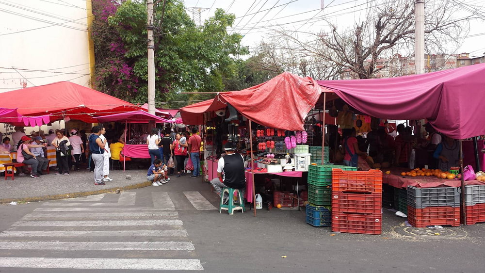
Photograph by Rita Mariana Oznaya Angeles, 2016.
Address: Gral. Felipe Ángeles, Bellavista, Álvaro Obregón 01140
Description:
For almost 50 years, this Sunday street market has been placed in this neighborhood by generation of families that have sold their products at their stalls, that are carefully distributed along two main streets, Zenzontle and Prolongación División del Norte, and has expanded to Gral. Felipe Ángeles street. Two delegates oversee the distribution of the stalls, making sure all vendors wear the official uniform. Vendors characterize by their kindness and good humor which...
Read more
Televisa San Ángel Group
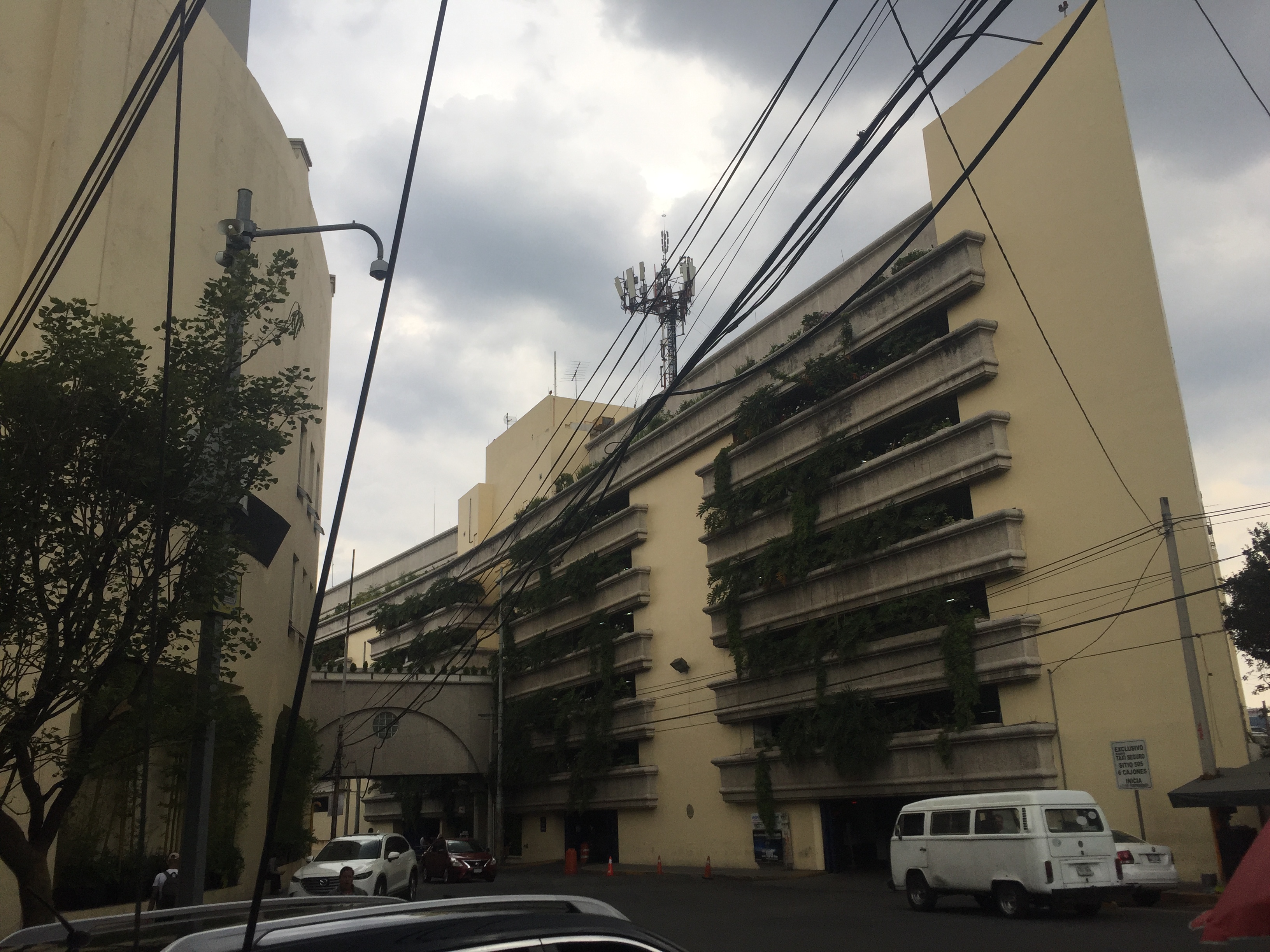
Photograph by Tania Andrea Maldonado Mansera, 2019.
Address: Blvd. Adolfo López Mateos 2551, Lomas de San Ángel Inn, Álvaro Obregón 01790
Description:
In 1960, San Angel Inn film studios occupied what is now Televisa San Angel. In 1968, Independent Television of Mexico (TIM) bought the land to house "Canal 8", one of the few Mexican TV channels at the time. The name inspired the sitcom "El chavo del 8", a character represented by Gómez Bolaños, "Chespirito", whose story tells the life of an orphan child who lives in a poor neighborhood. In 1973, the company merged with Televisa, changing the area...
Read more
'La bola" Park
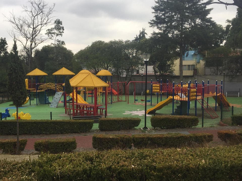
Photograph by Tania Andrea Maldonado Mansera, 2019.
Address: Av. Cabrío, Lomas de San Ángel Inn, Alvaro Obregón 01790
Description:
"El parque de la bola" owes its name to the water tank that feeds the nieghborhood of Lomas de San Angel Inn. The park was built on the old land of the Hacienda that was located in what were the studios of Canal 8, today Televisa.
Read more
Transmisiones Park
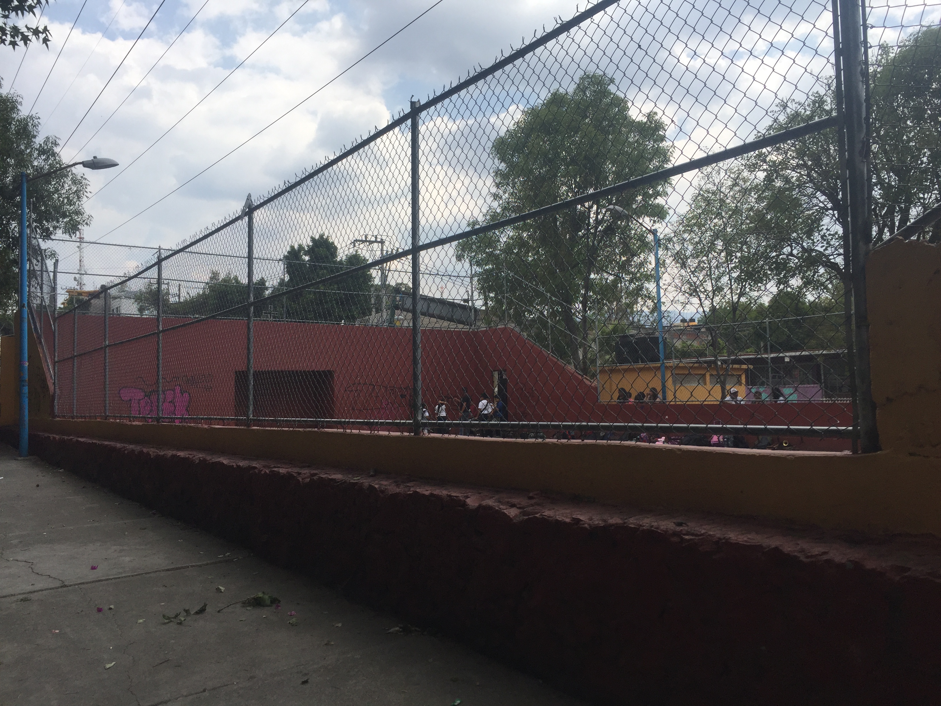
Photograph by Tania Andrea Maldonado Mansera, 2019.
Address: Transmisiones, Lomas de San Ángel Inn, Alvaro Obregón 01790
Description:
On the farming land of the “San Angel Inn” manor, the Bank of Mexico built houses for its employees. To combat insecurity, right accross these houses, a park was built with soccer and basket ball courts. Children playing with the elementary school band, Enrique Coca Pérez, rehearse every Friday on these grounds. Over the weekend, it is common to see people playing soccer at this park that unites the community.
Read more
Ing. Benjamín López Nieto
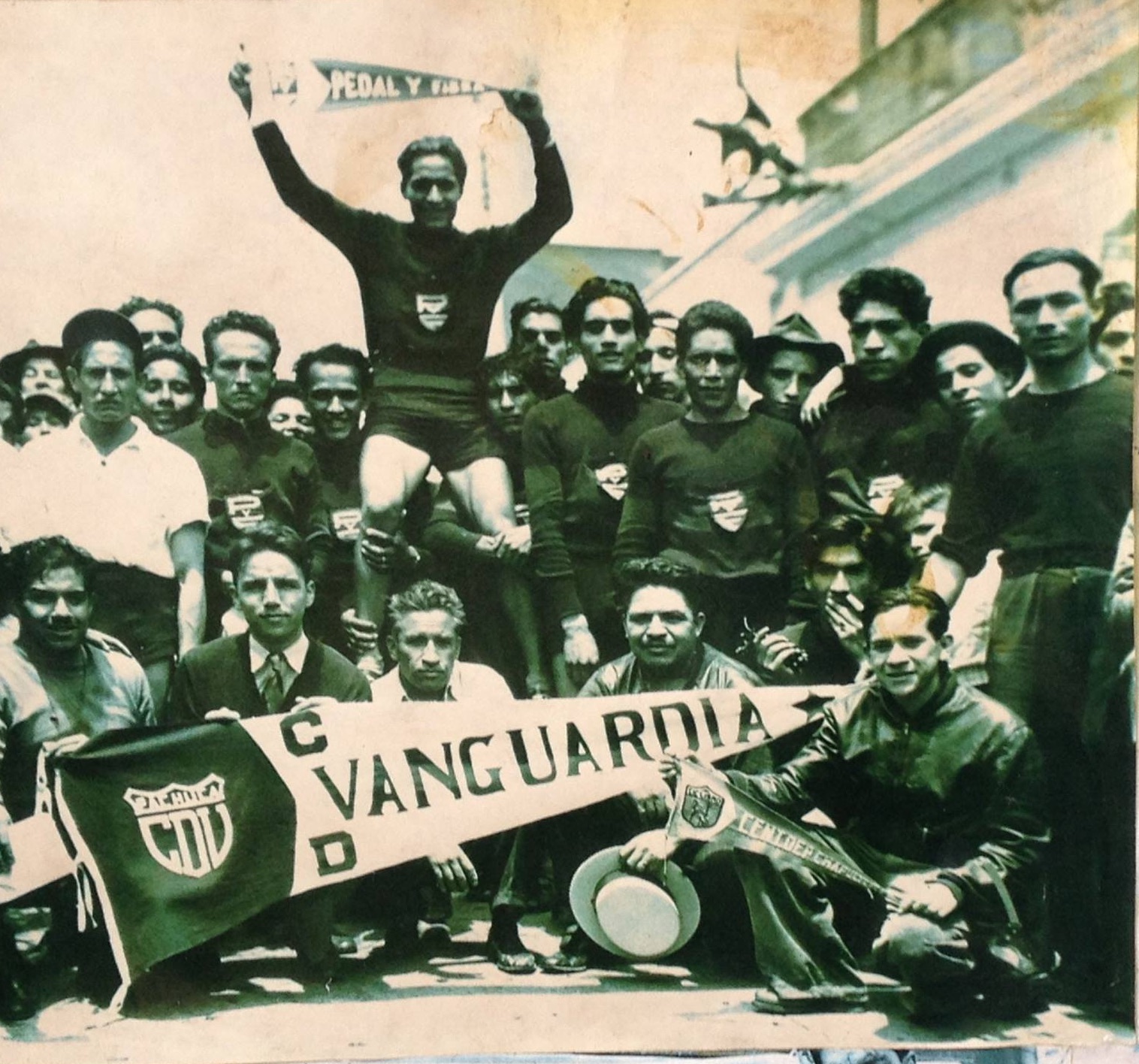
Photograph by Archivo López Nieto
Address: Transmisiones and Rómulo O'Farril
Description:
In 2013, Benjamín López Nieto passed at the age of 94, was a distinguished member of this community. The "engineer", as he was known, was a "cycling champ" of the 'Pedal y Fibra Club'. He built several facilities for the Politécnico Nacional.
Read more
Transmisiones street market
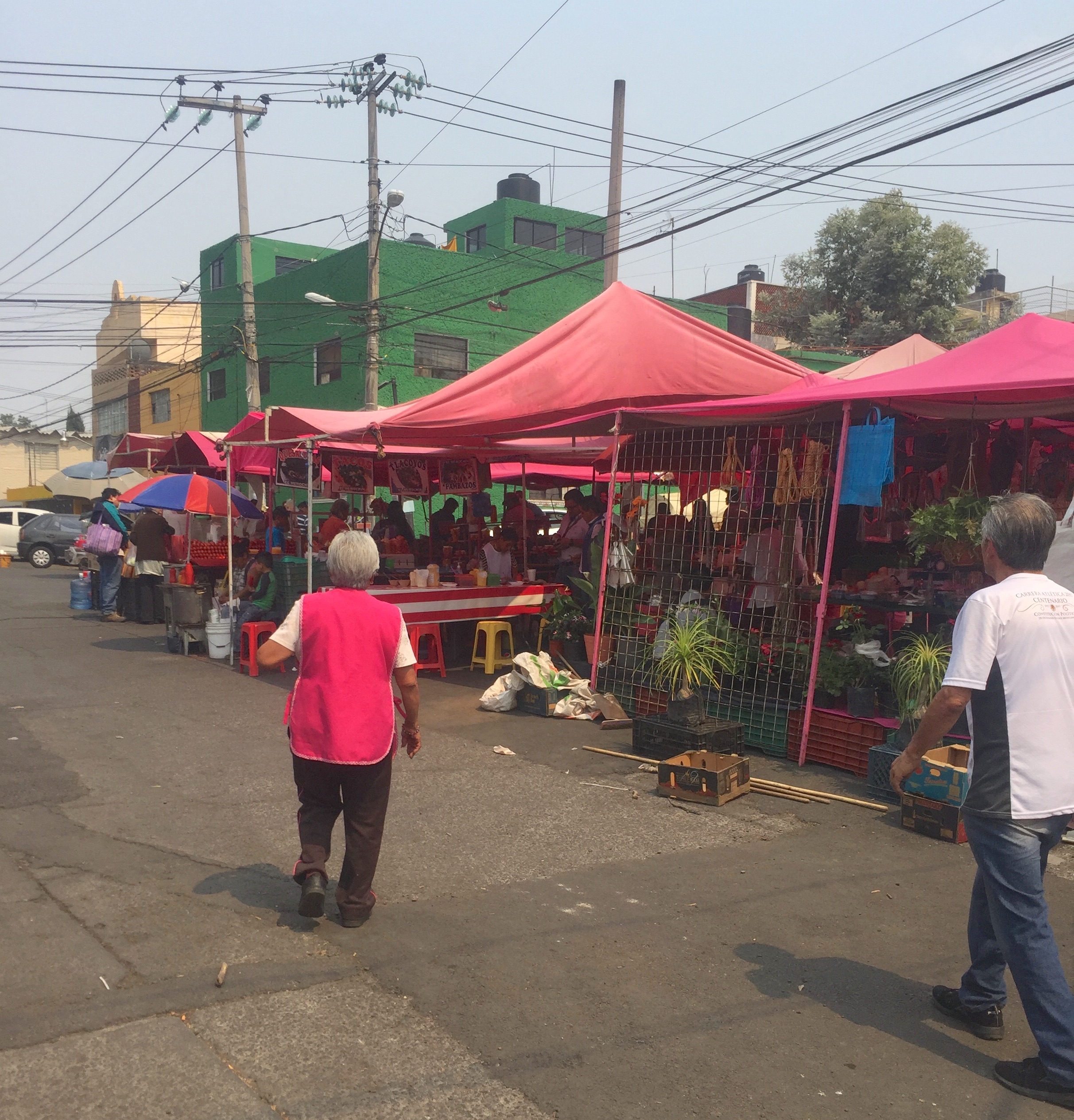
Photograph by Tania Andrea Maldonado Mansera, 2019.
Address: Transmisiones, Olivar de los Padres, Alvaro Obregón 10790
Description:
Olivar de los Padres is a neighborhood named after the religious order of the Carmelites planted olive trees on its hills. Every Tuesday, this market covers most of the street where residents of this area having buying all kinds of products for decades.
Read more
'Maestro Enrique Coca Pérez' Elementary School
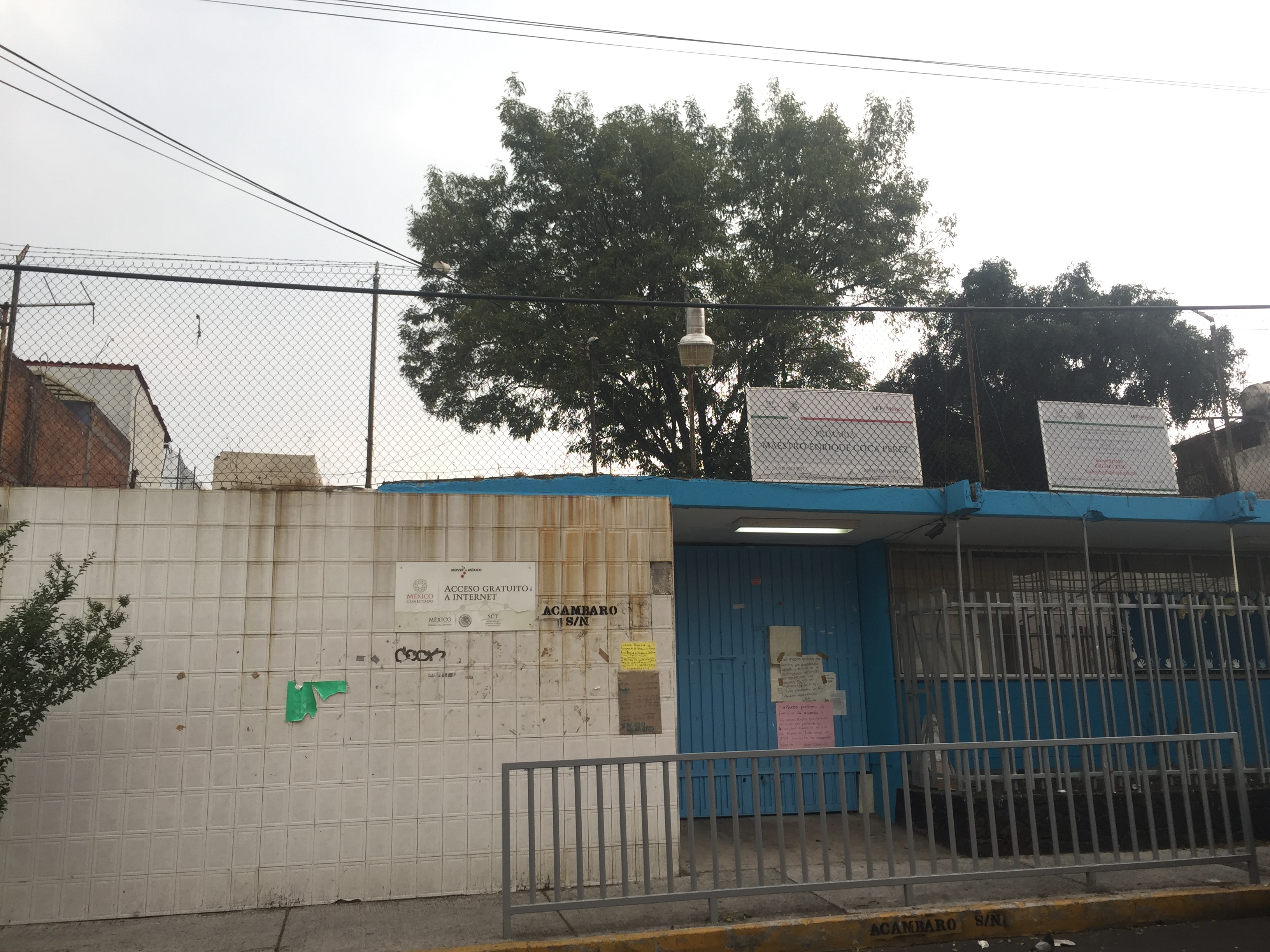
Photograph by Tania Andrea Maldonado Mansera, 2019.
Address: Acámbaro S/N, Olivar de los Padres, Alvaro Obregón 01780
Description:
Maestro Enrique Coca Pérez Elementary School has trained students for more than 50 years. The scholl has 12 classrooms, a computer room and a playground. The school has a war band, known as the ‘Cocos’
Read more
Street Market on Salvatierra Street
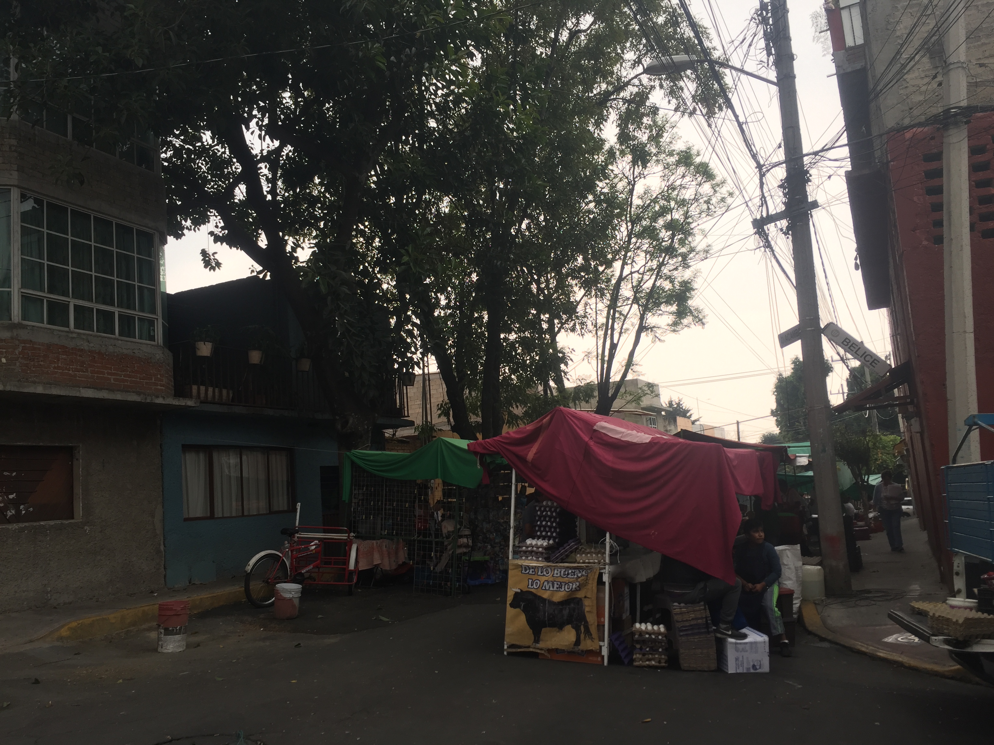
Photograph by Tania Andrea Maldonado Mansera, 2019.
Address: Salvatierra 79, Lomas de San Ángel Inn, Álvaro Obregón 01790
Description:
This is a family street market placed on Salvatierra Street since the early 1960s. Every Thursday, family generations have sold their products on this street in which bycicles could be rented many years ago and ‘El Farolito’ was the only grocery store in the area.
Read more
Cuernavaca Railway Biking Path
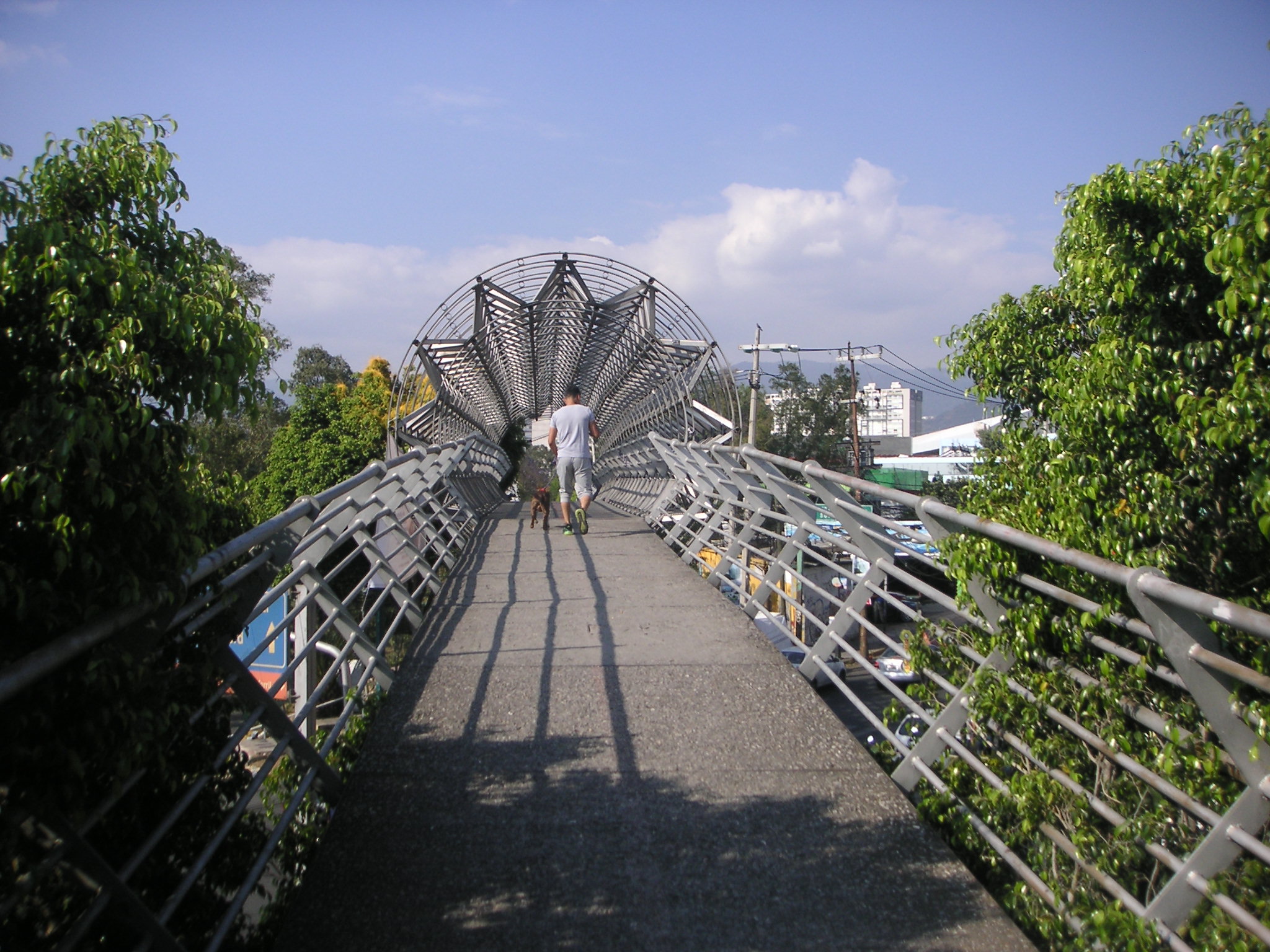
Photograph by Tania Andrea Maldonado Mansera, 2019.
Address: Ciclopista Ferrocarril de Cuernavaca, Ciudad de México, CDMX
Description:
The bike path was built on the old Mexico-Cuernavaca and the Pacific railroad, built by President Porfirio Díaz, on December 11, 1897. In this area of Tizapan, employees of the Mexican Railways Section C1 built their houses and maintained the train tracks. The path was a failed investment by the Mexico City’s government in 2004, as it is hardly used for biking.
Read more
Durango Street Market
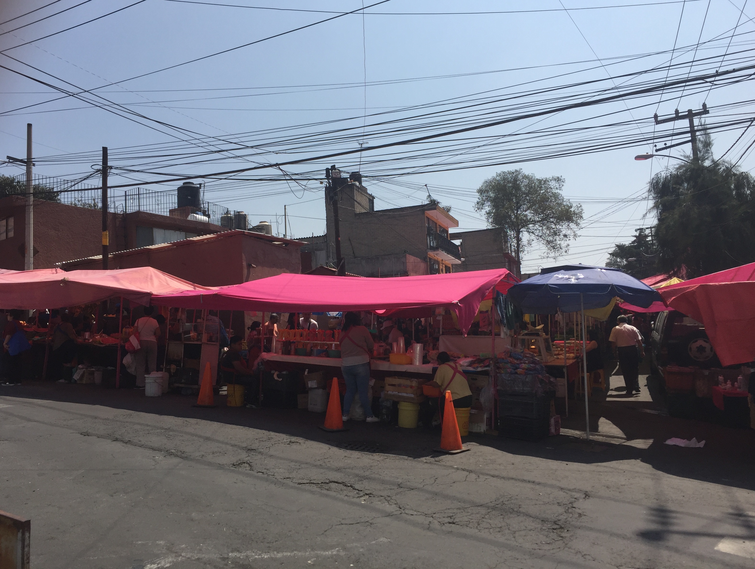
Photograph by Tania Andrea Maldonado Mansera, 2019.
Address: Durango, Progreso Álvaro Obregón 01080
Description:
This street market is one of the largest in Tizapán. Up to four rows of stalls with an incredible variety of products can be visited every Sunday from 7 AM to 5 PM.
Read more
Anillo Periférico
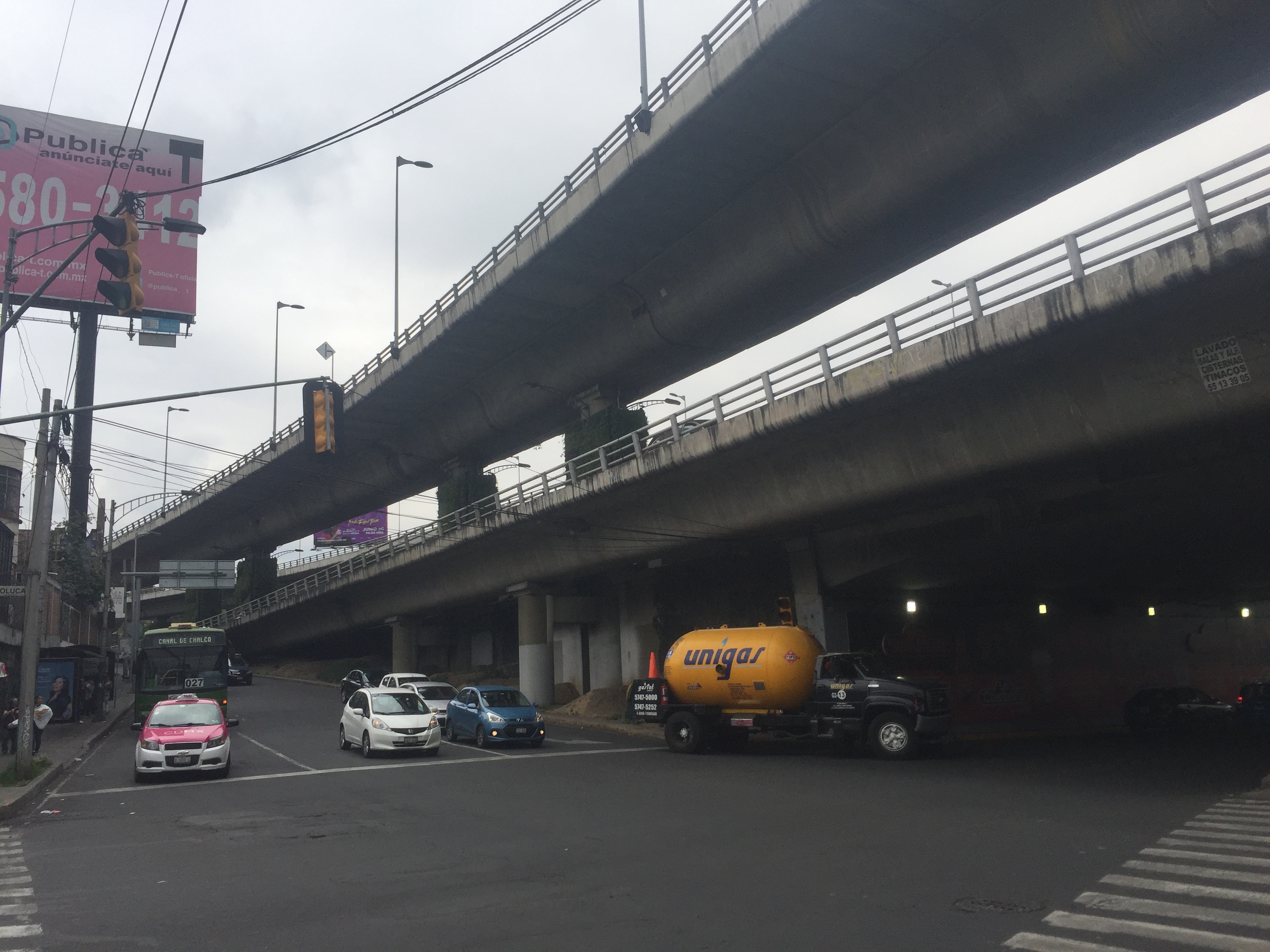
Photograph by Tania Andrea Maldonado Mansera, 2019.
Address: Anillo Periférico, Álvaro Obregón 01790
Description:
Mexico City’s planners have adapted the city to its traffic. In 1925, architect Carlos Contreras proposed the construction of two arteries for the city, one of them known as Periférico, a circular bypass, that created many as it was completed until very recently. Crowning the bypass is a second artery built in 2005, favoring a few areas along its route.
Read more
Market 6 de enero de 1915
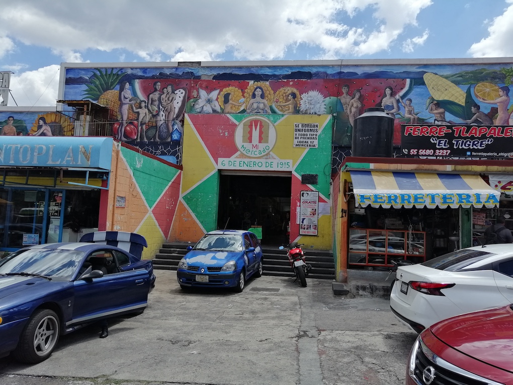
Photograph by Gonzalo Martínez Domínguez, 2020
Address: Rosa Blanca 156, Molino de Rosas, Álvaro Obregón 01470
Description:
The market was constructed in 1949. It name references to the date when the Agrarian Law in Mexico was issued. In addition to offering basic products, the market, is the largest in Colonia Molino de Rosas, has affordable restaurants, hardware stores, hairdressers and laundries.
Read more
Park Molino de Rosas
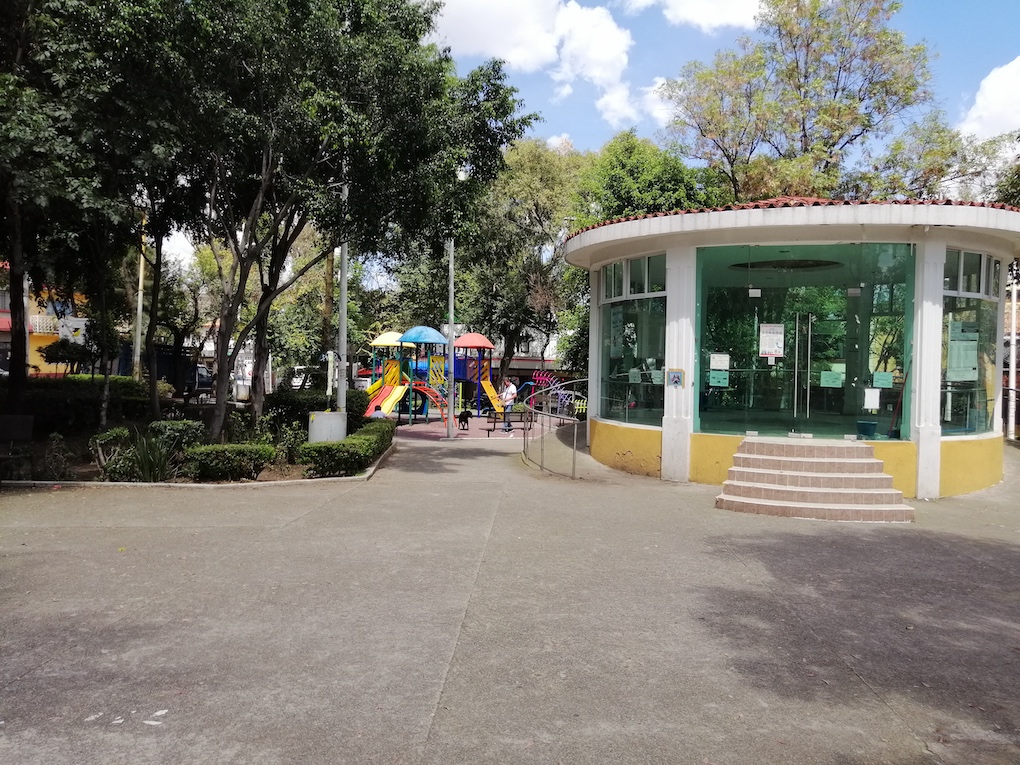
Photograph by Gonzalo Martínez Domínguez, 2020
Address: Rosa de Fuego, Molino de Rosas, Álvaro Obregón, 01470
Description:
This park was the first to be built as a neighborhood initiative. The inhabitants of Molino de Rosas financed the granite benches that were placed around the park.
Read more
Mount Carmel Parish
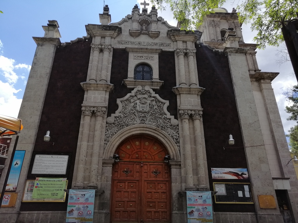
Photograph by Gonzalo Martínez Domínguez, 2020
Address: Juan Cousin 48, Alfonso XIII, Álvaro Obregón, 01460
Description:
The church was built around the 1970s. The catholic church, which celebrates the Blessed Virgin Mary of Mount Carmel, according to one of the inhabitants of the colony, had small stools instead of benches, which, by the way, were added during a wedding sometime ago.
Read more
Park Alfonso XIII

Photograph by Gonzalo Martínez Domínguez, 2020
Address: Franz Hals, Alfonso XIII, Álvaro Obregón, 01460
Description:
This park, recently remodeled, was the second to be built in the neighborhood. It is a place highly visited, as it hosts handicrafts market, even political events.
Read more
Alfonso XIII Open Market
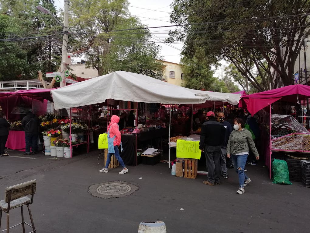
Photograph by Gonzalo Martínez Domínguez, 2020
Address: Guido Reni, Alfonso XIII, Álvaro Obregón, 01460
Description:
Along Guido Reni Street, this open market, the first to be established in the neighborhood offers groceries, home products and clothes, at very good prices.
Read more
Divine Providence Church
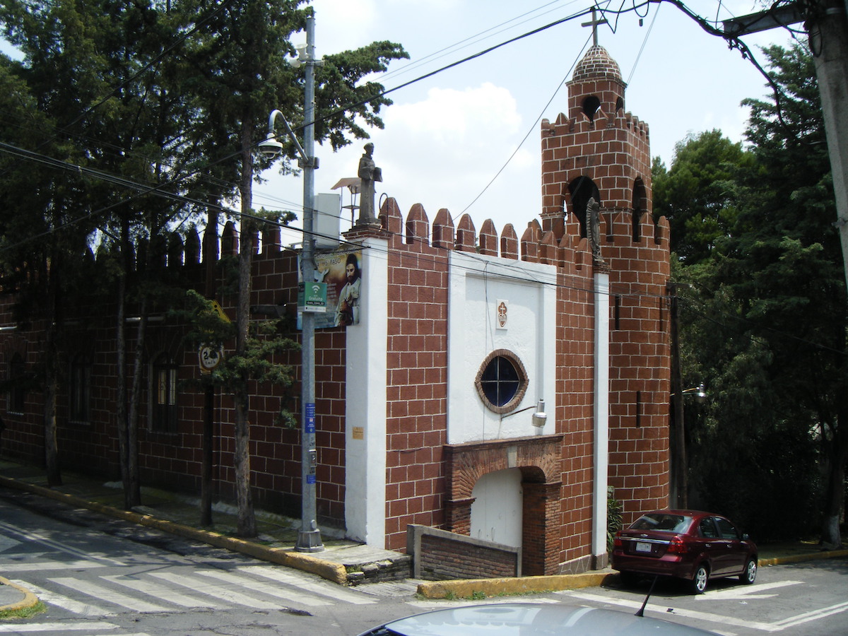
Photograph by Gonzalo Solís Sánchez, 2020.
Address: Independencia 1, La Angostura, Álvaro Obregón 01770
Description:
The great-grandfather of one of interviewed neighbors of Colonia La Langostura donated the land for the construction of Divine Providence Church, attended by families who celebrate mass and other social events.
Read more
Madre Teresa Dueñas Clinic
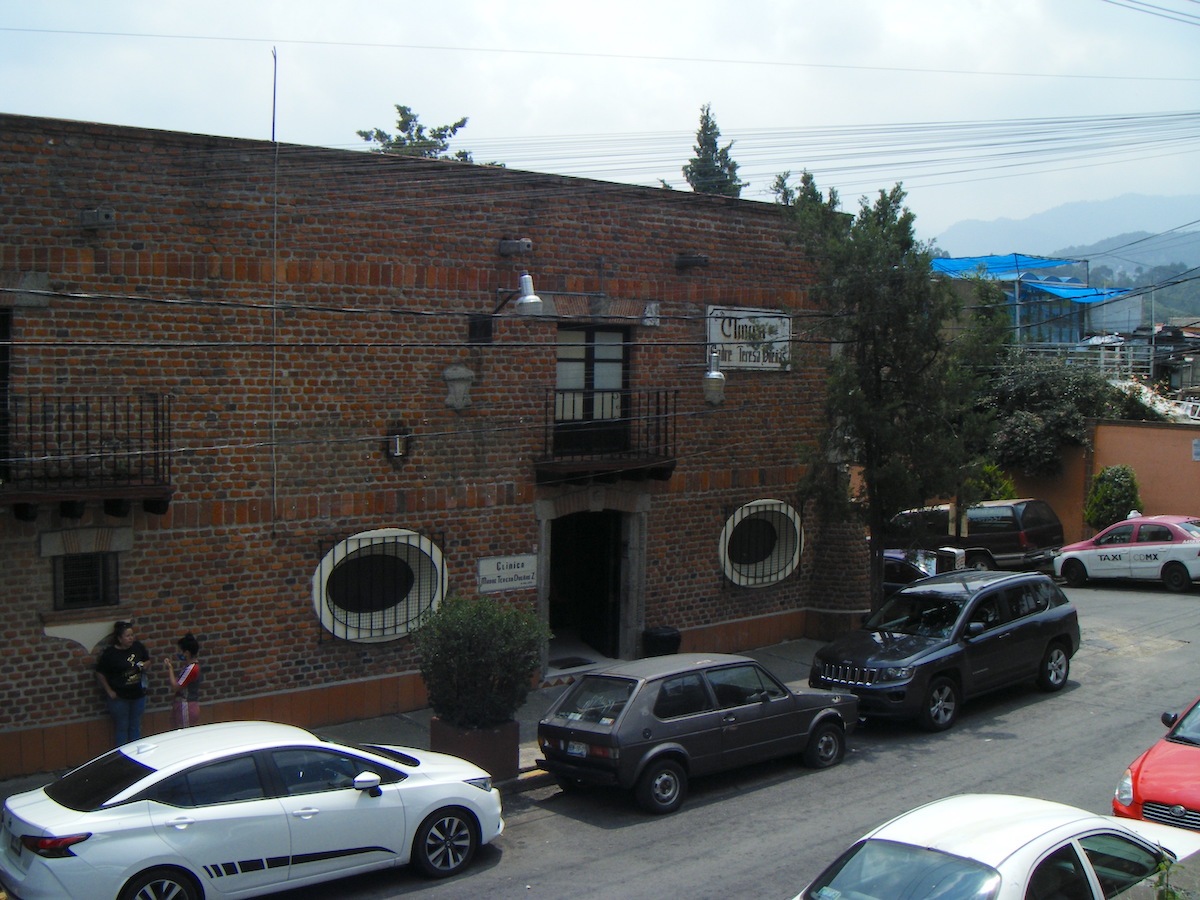
Photograph by Gonzalo Solís Sánchez, 2020.
Address: Transmisiones 1, La Angostura, Álvaro Obregón, 01770
Description:
On December 8, 1976, Father Gustavo Guerrero saw his efforts come into fruition with the inauguration of this clinic, which is run by the religious congregation of nuns of the Order of Christ Child and of Our Lady of Fátima. The clinic provides spiritual, financial and health assistance to the community.
Read more
La Angostura Soccer Field
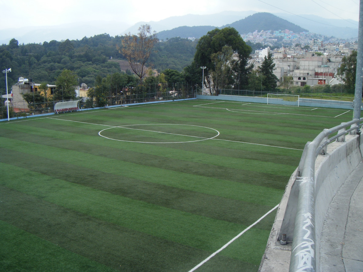
Photograph by Gonzalo Solís Sánchez, 2020.
Address: Av. las Torres y Transmisiones s/n, La Angostura, Álvaro Obregón, 01770
Description:
Remodeled in 2018, the soccer field holds sport event attended by numerous people, mainly on Sunday. The soccer field is an important source of income for nearby vendors who offer beer and snacks to those who come to enjoy a match.
Read more
La Angostura Water Tan
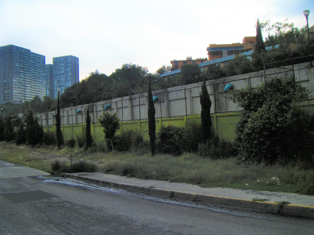
Photograph by Gonzalo Solís Sánchez, 2020
Address: Av. De Los Tanques 348, La Angostura, Álvaro Obregón, 01770
Description:
La Angostura scarcely suffers from the regular water shut downs that most neighboring areas go through thanks to this tank. Its fencing stamps the landscape and prevents the explosive expansion of residential developments throughout this environmentally crucial area for Mexico City.
Read more